Most of the low-volume road network in the world is gravel or earth. It is also the part of the network that is surveyed least. In many municipalities somebody drives the roads once a year, if there is time, and the rest of the condition information arrives as complaints from residents. That is subjective, slow and expensive per kilometre, and it never shows the whole network at once.
A satellite passes over every one of those roads every few days. The question we are now working on is whether it can see enough to tell a road manager which sections need light grading, heavy grading, spot regravelling, regravelling or ditching, and when.
If you manage gravel or unpaved roads, we would like to hear from you before we build anything. Answer the SatRoads questionnaire. The questions marked ★ take about 20 minutes.
What we are building
SatRoads is a six-month feasibility study in the European Space Agency’s Business Applications programme, in its call for rural transportation networks. It started in October 2026 and ends in April 2027. SirWay carries out the study under a Kick-Start cooperative agreement with ESA and builds the link to road asset management. AstraTerra (UK) works with us on satellite image processing, GNSS and system engineering.
The service we are studying works in five steps:
- Seasonal trigger. Images are taken when damage appears: in spring after the thaw or the wet season, and in autumn before the freeze.
- Images. Copernicus Sentinel-2 (free, 10 m) screens the whole network. Very-high-resolution satellite images (30–50 cm) look closer where it matters. Sentinel-1 radar sees through clouds.
- Defects. Each road corridor is cut out along the centreline from the road register, and the images are analysed for the defect types below.
- A condition class per section. The defects are combined into a Gravel Road Condition Index (GRCI), a class from 1 to 5 for each 100-metre section, with the defect that sets the class.
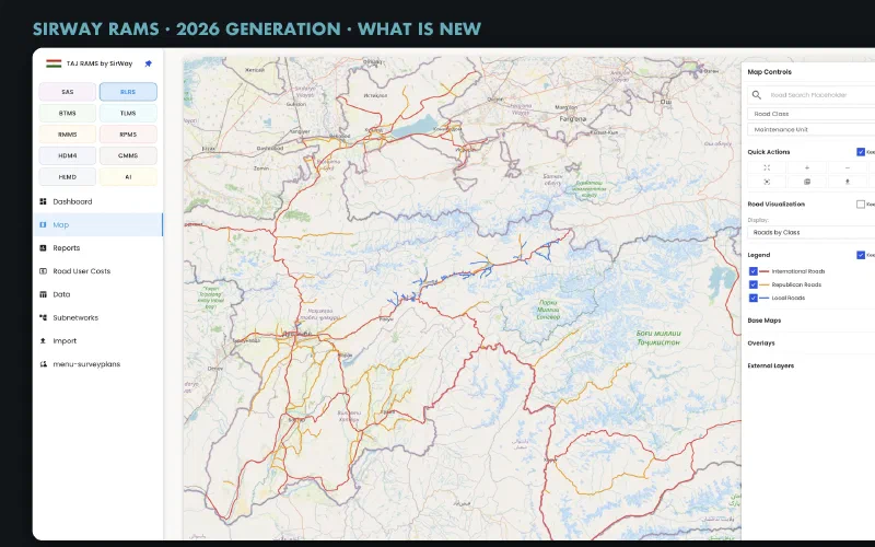
- Into maintenance planning. The classes go into SirWay RAMS on the map, in reports and in the maintenance programme, with a suggested action per section and its cost.
What a satellite can and cannot see
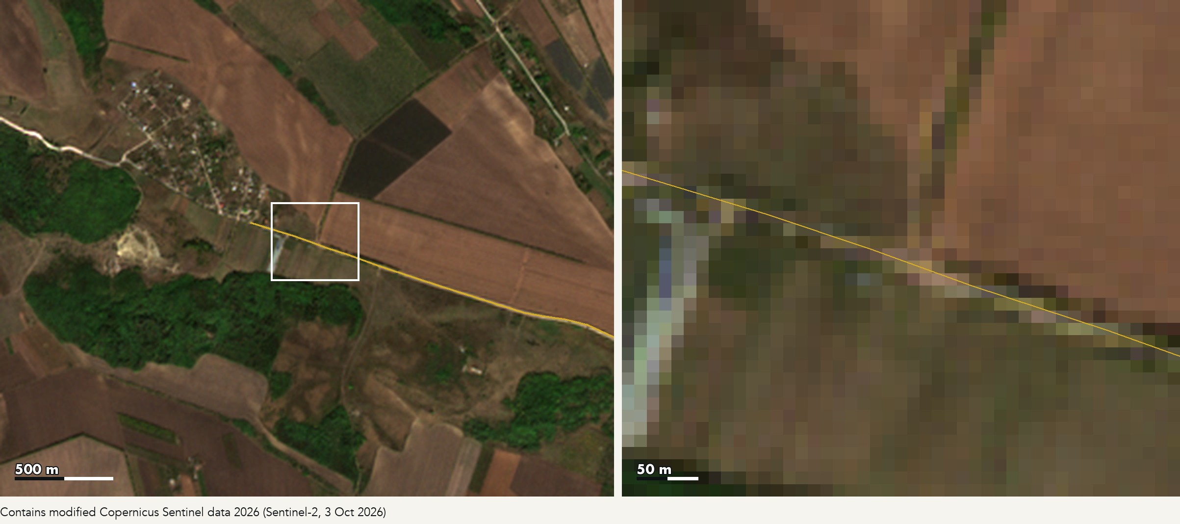
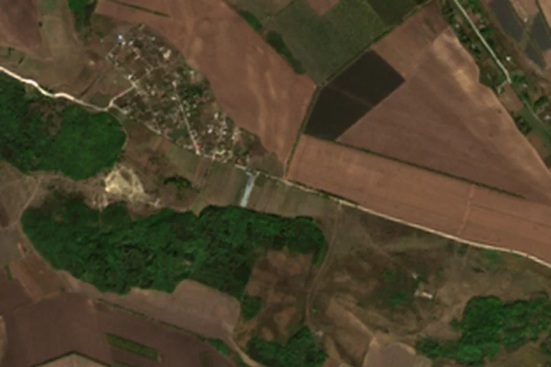
The picture above is real. It is a Sentinel-2 image from 3 October 2026 over one of the gravel roads that the City of Chișinău shared with us. The road is clearly visible across the fields, but on the right you can see the limit: a 5–7 m road is about one 10 m pixel wide. Sentinel-2 can show that something has changed along a road, that water stands on it or that vegetation is closing in. To count potholes or measure ruts, you need the very-high-resolution images, and those cost money per square kilometre.
That is why this is a feasibility study. We will report honestly which defects can be detected, from which images, how often and at what cost per kilometre. Grading also makes the job harder: it wipes out surface defects in a day, so an image is only useful if we know when each road was last graded.
Eight defects, seen from the ground
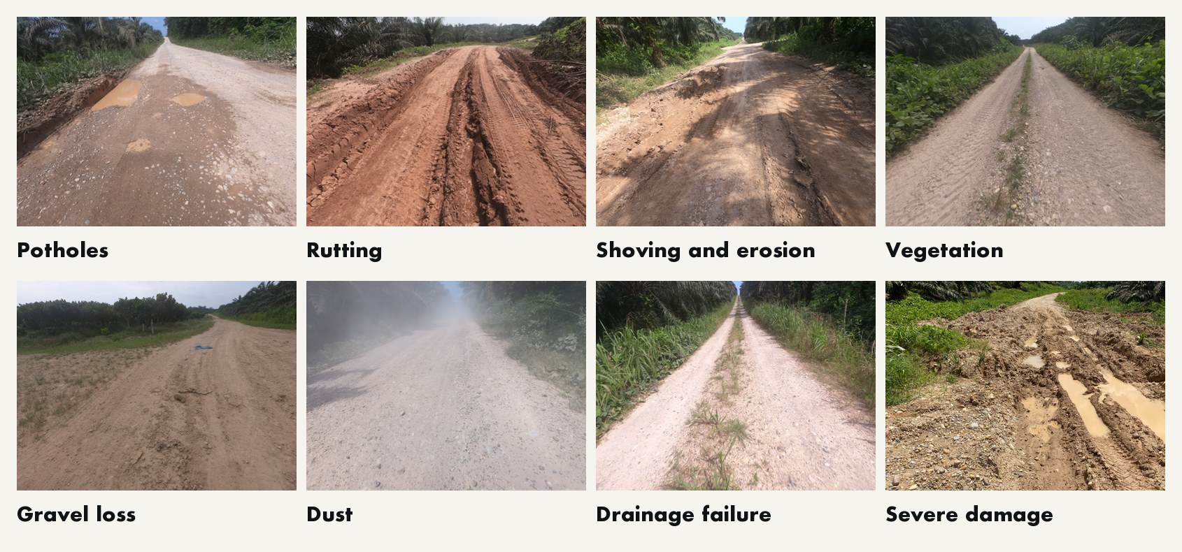
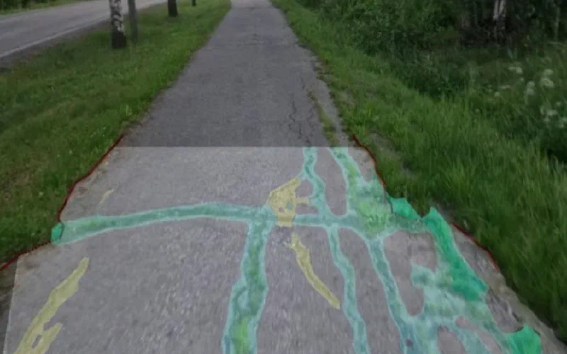
These are the defects the index is meant to capture, photographed on our earlier field projects. Each points to a different action: potholes to spot regravelling, rutting to heavy grading, gravel loss to regravelling, drainage failure to ditching and culvert repair. In the pilots, satellite images are checked against inspections on the ground within a few days of the image.
Where we test it
We are preparing pilots with road owners who manage large gravel networks under very different conditions:
- City of Chișinău, Moldova
- South-Eastern Finland Economic Development Centre, which manages state gravel roads in the region
- Viru-Nigula Municipality, Estonia
A northern climate with spring thaw, a continental one with dry summers, and a municipality, a city and a state road authority: if the method works across all three, it is likely to work elsewhere too.
Why your answers matter
Three pilots are not a market. We want to hear from road managers everywhere: municipalities, state and regional road authorities, private road associations, forest companies and maintenance contractors. Your answers decide:
- which defects the index must detect, and which maintenance actions they lead to;
- how often and when the information is useful: after the thaw, before the summer works, at budget time;
- in what form it should arrive: section length, a map, a report, or straight into your own system;
- what it is worth: what condition monitoring costs you today, and what a service would have to cost to pay for itself.
The answers go into the user requirements that we present to ESA in January 2027, so the earlier you answer, the more they shape the result.
How it works. Answer only the ★ questions if time is short (about 20 minutes); you can skip any question. Estimates are enough. Answer in English, Finnish, Estonian or your own language; we translate. Answers are confidential and reported only in aggregated form, and no organisation is named without permission.
What you get. A service designed around your network instead of ours, and a summary of the results: email us and we will send it to you when the study ends. If you would like your own roads to be part of the next step, the spring 2027 campaign after the thaw, tell us that too.
Questions: Dr Konsta Sirvio, project manager, SirWay, tel. +358 40 823 3890. Please share the link with colleagues who manage gravel roads.
Who does the work
SatRoads is carried out by SirWay (Finland) with the support of the European Space Agency under its Business Applications programme. AstraTerra (United Kingdom) provides Earth observation image processing, GNSS and system engineering expertise to SirWay. The pilots are prepared with the City of Chișinău, the South-Eastern Finland Economic Development Centre and Viru-Nigula Municipality. The condition data flows into SirWay RAMS.
The view expressed in this article can in no way be taken to reflect the official opinion of the European Space Agency. Satellite image: contains modified Copernicus Sentinel data 2026.