A road asset management system is a management system, not a piece of software. The ones that fail do so when the funding dries up, the survey equipment breaks, the data goes stale or the people who built it move on. The 2026 generation of SirWay RAMS is built to survive all four: one login, one map, one budget picture, in the user’s own language, on any device, with no server to buy, with data that is cheap to refresh and a financial case that can be defended. This article lists what is new.
One platform, thirteen modules
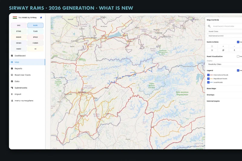
The system is modular, and the menu each user sees is configured per organisation and role rather than coded. The platform’s modules are:
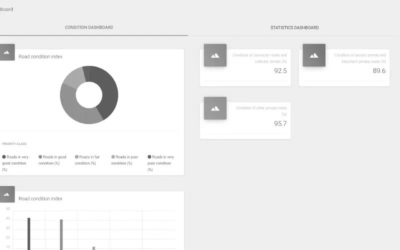
- High-Level Management Dashboard (HLMD): a customisable home page with drag-and-drop widgets, plus dashboards for statistics, KPIs, traffic, roads, bridges, maintenance planning, contracts and data collection.
- Road Location Referencing System (RLRS): the road and section register with every asset referenced to road, section and chainage, roughness (IRI) and photo imports, sub-networks, survey plans, transport corridors, road user costs and an approval queue for changes to the reference network.
- Interactive GIS (IGIS): map layers for roughness, cracking, potholes, traffic, condition index, planning results, hazards, climate zones, corridors and photos, served as vector tiles and WFS, with layer management and map services.
- Bridge and Tunnel Management (BTMS): inventories and inspections for bridges, tunnels, galleries and retaining walls.
- Traffic Load Management (TLMS): manual counts, traffic stations, axle loads, equivalent standard axle loads per section and the vehicle fleet.
- Road Maintenance Management (RMMS): needs assessment, work packages, operational plans, cost-benefit analysis, work reports and execution forms.
- Road Performance Management (RPMS): KPI thresholds and evaluation, and road asset valuation.
- HDM-4 Integration: workspaces, the HDM-4 matrix, export in HDM-4 format, results and eight network analysis reports.
- Contract Management (CMMS): contracts and lots, payments, bills of quantities, work orders and progress tracking.
- AI Assistant: see below.
- Data Collection Application (DCA): the offline mobile application for inventories, inspections and hazards.
- Climate Risk and Adaptation (CRA): in development, see below.
- System Administration (SAS): users, hierarchical roles, organisations, audit log, data dictionary, localisation and approval queues.
Ask AI: questions in plain language, answers from your own data
The AI assistant lets anyone with the right permission type a question in their own language and get an answer drawn from the live RAMS database. “Which sections of the national network have roughness above 6 and no works planned?” comes back as a table, with a one-click download for Excel. Conversations are saved and can be reopened.
Under the surface the assistant writes read-only database queries, one at a time, against the schemas it is allowed to see. It cannot change data. Every query runs under the user’s own row-level permissions, with a time limit and a size cap, and is written to the audit log. The language model is interchangeable.
AI distress detection
Condition surveys are the most expensive part of asset management, and the most common reason plans go stale. SirWay’s distress detection model reads ordinary survey footage frame by frame and outlines potholes, edge breaks and other distresses as polygons, so area and extent are measured rather than boxed, each with a severity grade and a chainage. An engineer reviews the detections before anything counts, and the accepted results load into the road register, so the whole network can be surveyed every year.
Climate Risk and Adaptation: the module being built
Road networks in mountainous and flood-prone countries lose more to one bad season than to ten years of normal wear. The Climate Risk and Adaptation module, now in development, brings that risk into the same system as the inventory, the map and the plan. It follows the adaptation pathways approach that development banks now ask for, and it is being built on real hazard data from the networks we work on.
- Hazard screening. Flood by return period, landslide susceptibility, rockfall source zones, debris flows, seismic hazard, heat stress, sea level rise and scour at structures, under selectable climate scenarios and time horizons. Each road section takes the worst class of every hazard it crosses, the classes combine into one composite risk band, and the weights are data the agency signs off, not constants in code. Expected annual damage is summed per section and for the network.
- Network criticality. Any section can be closed in a disruption scenario to see the detour length, the vehicle-hours lost, the people cut off, and the hospitals, schools, airports and border crossings that lose access.
- Adaptation options. Protect, strengthen, accommodate, retreat or maintain, each costed from the agency’s own unit rates, screened for robustness across climate futures and ranked by benefit-cost ratio. Rejected options stay on record with the reason.
- Adaptation pathways. Options are sequenced on a pathway map with tipping points, and the trigger indicators are read from data the agency already keeps: rainfall gauges, field reports from the Data Collection App, closure hours, work orders and condition surveys.
- Investment programme. The medium-term programme shows residual expected annual damage, funding sources and development-bank classification per package. Approving it writes the work orders into the maintenance module and the economic case into HDM-4; nothing is re-keyed.
Climate risk changes the programme at four points: inspection frequency, treatment selection, prioritisation beside condition and traffic, and a separate resilience works category with its own budget line. The works catalogue behind it, with unit costs, is already shaped to the RAMS maintenance tables.
The current release already holds the foundations: a natural-hazard inventory of rockfalls, floods, landslides, avalanches and erosion sites with an 18-factor risk score ranked on the map and captured in the field with photos; eleven climate zones that feed the HDM-4 deterioration models; bridge scour and flood fields; and culvert, drainage and retaining-wall inventories.
Bridges, tunnels, galleries and retaining walls
The bridge and tunnel module covers inventory, condition and intervention inspections with element conditions, smart flags and inspection files. A deterministic deterioration forecast projects condition forward, and the bridge planner selects works against a budget using bridge priority and condition indices, on the same platform and the same budget picture as the roads.
Multi-criteria maintenance planning and financial analysis
Maintenance planning in the 2026 generation is multi-criteria and integrated. Each section of the network is ranked on the criteria that matter to the agency, with weights the planner sets: Net Present Value, condition, social impacts and strategic importance. Planning then works at ten-metre resolution. Candidate works are generated per segment, ranked by benefit-cost ratio and picked against the available budget, then grouped into work packages and operational plans. The financial analysis runs on the same data: net present value and internal rate of return over a twenty-year horizon from road user cost savings, so each work can be defended on its economics, not only its condition. Where a strategic analysis is needed, the HDM-4 module exports the network in HDM-4 format and brings results back, linked to the tactical plan. KPIs and asset valuation show management and funders what the money bought.
Built for the whole organisation
- Unlimited users on any device, hosted by SirWay.
- Hierarchical roles, organisation hierarchy, two-factor authentication and row-level security in the database.
- A full audit log.
- An interface that can be localised to any language: translations are data the administrator edits, not code, and each deployment runs in the languages its users need.
- The Data Collection App works offline, captures GPS and photos, and sends sessions to a supervisor for review before they enter the system.
From one country to the next
The same code base is configured per country: modules, menus, languages, lookup tables and unit costs are data, so a new deployment starts from a working system rather than a blank page.
If you want to know how far your organisation is from this, take the RAMS maturity self-assessment.