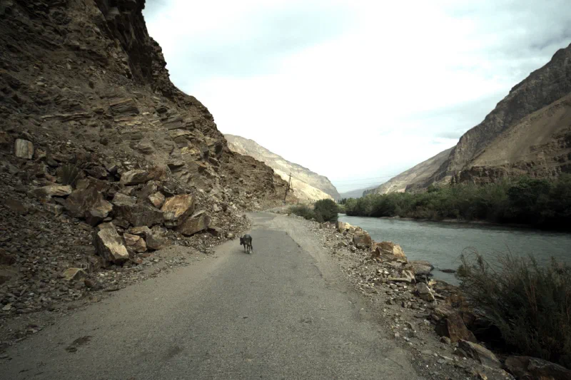
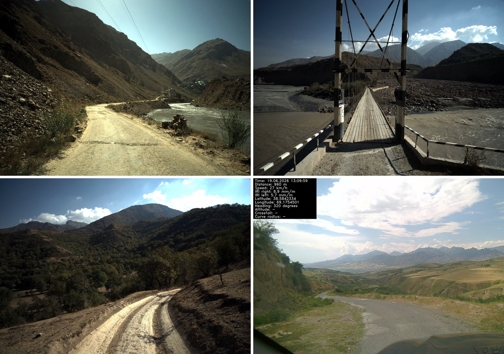
The photo above was taken by the Ministry of Transport’s survey vehicle in August 2024, at about 2,800 metres. Rock has come down onto the road; the river is on the other side. With its roughness measurement and GPS position, the photo is now in Tajikistan’s national Road Asset Management System (RAMS), on the map, at the right kilometre.
The ministry signed the contract with FinnOC and SirWay in 2025, in a project financed by the World Bank. Today every component of the system runs in production on the ministry’s own servers at its Digitalisation Centre in Dushanbe, and the ministry has accepted it. Its first analysis has already shown what a road budget really costs.
The starting point
Tajikistan is mostly mountains. The Ministry of Transport manages about 14,500 km of public roads, international, republican and local, much of it built before 1970 for far lighter traffic than it carries today. Roads close in winter, and rockfalls, floods, landslides and avalanches cut them in spring and summer. Some regional offices work with unreliable power and internet.
Data existed, but in pieces. The ministry had bought a survey vehicle in 2023 and measured roughness and taken road photos on the main roads. A JICA project had inventoried more than 1,600 bridges, in Excel. Forty traffic-counting stations from an earlier project had stopped working. As in many countries, data had been collected during donor projects and then not kept up.
What the system holds
- The road network: about 14,500 km of public roads with centrelines, sections, road classes and location referencing that puts every record at a kilometre and chainage.
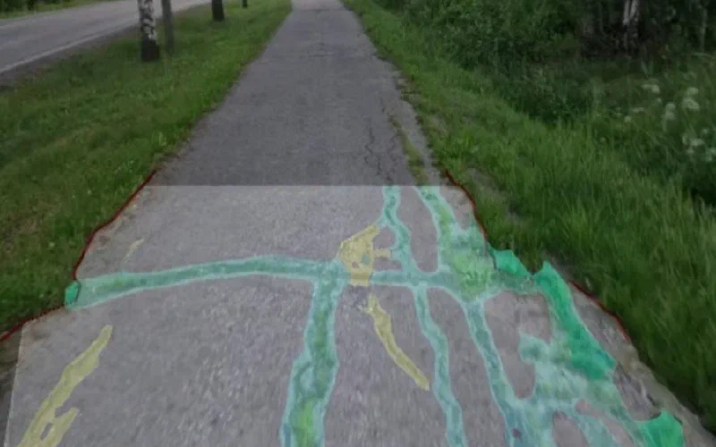
- Condition: survey tracks, roughness (IRI) from bump and laser devices, surface types, lanes, condition classes and pavement defects, and road photos. Local roads are measured with a smartphone (IRIMETER-2), which prints the roughness on each photo.
- Structures: 2,323 bridges and 29 avalanche and landslide protection galleries, with photos and JICA’s inspection data, and a Bridge Condition Index where inspections exist.
- Natural hazards: rockfalls, floods, avalanches and landslides with location, date, criticality and photos.
- Traffic and loading: counting stations, manual and automatic counts, traffic volumes for 19 international and 77 republican roads, and an axle-load baseline for the equivalent standard axle (ESAL) factors.
- Planning data: 11 climate zones, 594 sets of HDM-4 defaults, the vehicle fleet, deterioration models, road user cost tables and contract lists.
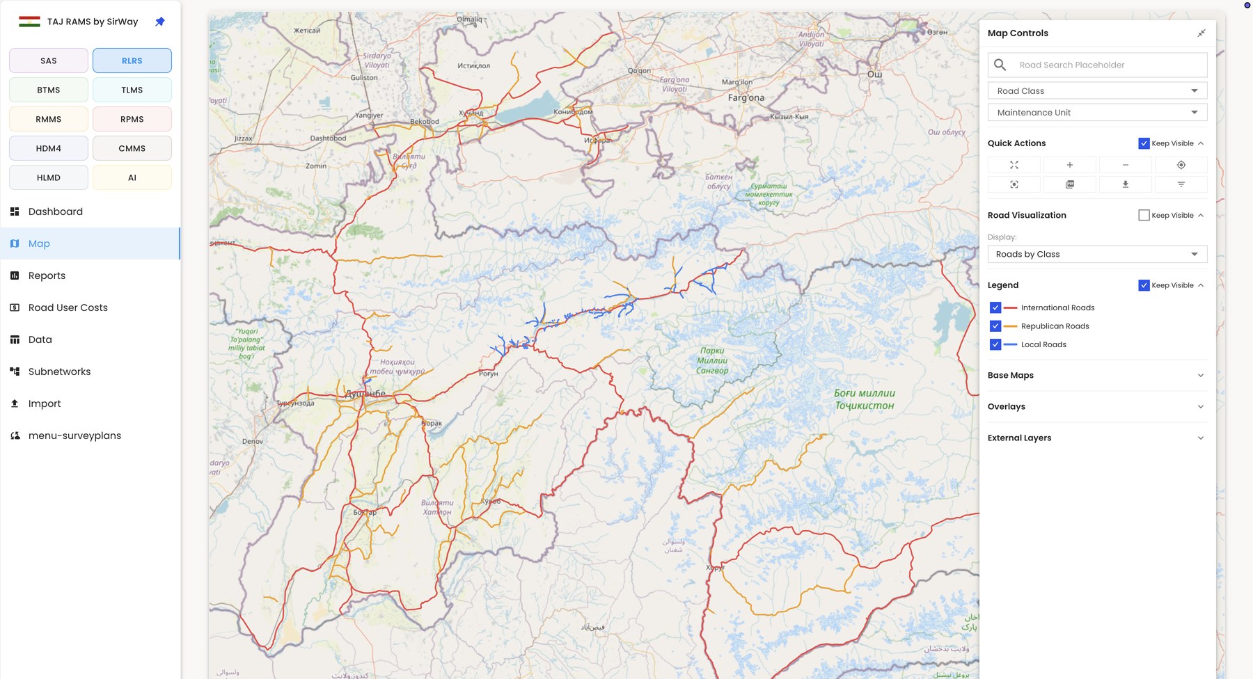
Twelve components
The ministry certified twelve components, all on one PostgreSQL/PostGIS database with the same roads and the same map:
- Central database: a network-referenced data model with an audit trail.
- RLRS and integrated GIS: road referencing, map layers, reporting, and editing from QGIS.
- TLMS, traffic and loading: counts, AADT, axle loads and ESAL factors, hourly and weekday profiles.
- RMMS, routine maintenance: needs, work packages, unit prices, annual plans, work reports and economic analysis.
- RPMS, road performance: indicators, condition classes, targets and trends.
- HDM-4 interface: exports the network to HDM-4 for strategic and programme analysis and reads the results back, with network reports.
- BTMS, bridges and tunnels: inventory, inspections and condition indices for bridges, tunnels and galleries, with a field app for inspections.
- CMMS, contracts: contracts, lots, bills of quantities, work orders, inspections and variations.
- HLMD, the management dashboard: roads, bridges, traffic, contracts and data collection on one screen, by organisation and road.
- SAS, administration: users, roles, organisation-based access and multi-factor login.
- Web portal: a public portal over HTTPS that works on a phone.
- Hosting and mobile data collection: the ministry’s own servers with backups, and a field app for surveys.
The interface and reports are in Tajik, Russian and English. Under load tests the worst response time stayed under four seconds at more than 1,000 requests an hour, with no failed requests.
How it was delivered
The order of work was the classic one, and the ministry signed off each step: inception and a review of the existing systems and data (2025), user requirements and specifications, then an alpha version that an independent reviewer assessed for the ministry against the tender.
Data migration was a project of its own. Survey files, registers, JICA and older datasets were snapped to the network, cleaned and loaded with more than 200 repeatable load steps, with automated checks on every build. Road lengths now come from one source.
Training came before acceptance testing. In January 2026 the ministry’s RAMS team was trained at the Digitalisation Centre, mostly in Russian: network management principles, data collection with the survey vehicle and the smartphone, GIS, updating the system, HDM-4, bridges, traffic, maintenance planning, and user and access management. Participants rated their own knowledge at 2.6 out of 5 before and 4 after. A second round followed in April, and every manual exists in English and Russian.
Beta testing was done by the users, not by us. In the summer of 2026 ministry staff ran 261 test cases on the real national network. 88% passed at first and 93% at the independent review, with no failures, and every request raised in the tests was completed before the ministry accepted the system.
The first results
The system’s first job was the one a RAMS exists for. In October 2026 its data fed the first strategic HDM-4 analysis of Tajikistan’s main road network for the ministry: 5,478 km of international and republican roads over 2027–2046, with the model calibrated to Tajik climate zones, vehicles, unit costs and maintenance standards. Three budgets were compared: an unconstrained optimum, a constrained optimum that spreads the backlog over 2027–2031, and today’s budget projections.
- The starting point. Average roughness is 7.3 m/km (IRI) on international roads and 10.2 on republican roads. Roads carry over 99% of domestic passengers, yet about 0.1% of GDP goes to road maintenance, against a regional norm near 0.4%.
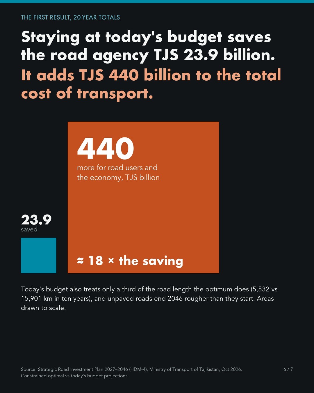
- Works. In ten years the constrained optimum treats 15,901 km; today’s budget treats 5,532 km, about a third. Regravelling disappears and widening is put off.
- Condition. At today’s budget the network is about 35% rougher, and unpaved roads end 2046 worse than they start.
- Cost. Over 20 years, today’s budget saves the road agency TJS 23.9 billion and adds TJS 440 billion to the total cost of transport, about 18 times the saving, because road user costs are 98% of that total.
The analysis recommends the constrained optimal budget as the sector target, protecting periodic and routine maintenance, priority for unpaved and republican roads, and building the RAMS and HDM-4 into the annual budget cycle.
What comes next
The warranty period is running, followed by three years of maintenance and technical assistance. Improvements keep coming: gallery inspections and condition indices, manual traffic counts with hourly and weekday dashboards, HDM-4 reports by budget scenario with a work-programme map, and bulk user import. With the ministry, the next data steps are gallery condition data, condition surveys of local roads and live axle-load data; the next analysis step is a section-level five-year programme.
What we learned
- The software is the easy part. Every module ran before its data was complete. A national RAMS is a management system; it lives or dies with data collection, the budget for it, and the people who keep doing it.
- Let the users test, in their own language. Acceptance tests run by ministry staff on their own network found what matters to them, from chainage display to sign counts per road, and made the system theirs.
- Plan for the mountains. Offices with weak power and internet, roads closed in winter and staff working in Tajik and Russian have to be planned in from the start, not discovered later.
- Put the first analysis on the table early. A ratio of 18 to 1 does more for the next budget than any number of maps.
Who does the work
The system was built for the Ministry of Transport of the Republic of Tajikistan by FinnOC and SirWay, under a project financed by the World Bank (IDA). It is based on SirWay RAMS. The analysis figures are from the ministry’s Strategic Road Investment Plan 2027–2046 summary (October 2026).